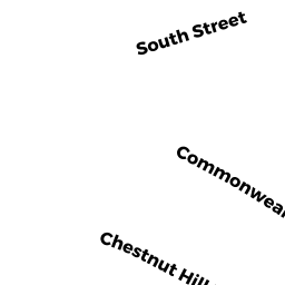
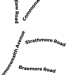
1945 COMMONWEALTH AV 26
Owner Information
SLD 1945 COMMONWEALTH AVE REALTY TRUST
50 CUTLER LANE
BROOKLINE, MA 02467


Property Details
1945 COMMONWEALTH AV 26 is classified as a Residential Condominium (Mid rise).
The primary structure on this property was built in 1932. There is 435ft2 of residential/living space within this property. This property is listed as having 2 rooms.
1945 COMMONWEALTH AV 26 is valued at $248,700. The land is valued at $0 and the structures are valued at $248,700.
The most recent deed for 1945 COMMONWEALTH AV 26 is recorded at the local registrar in Book 59726, Page 136. 1945 COMMONWEALTH AV 26 was last sold on Thursday, June 14, 2018 for $250,000.
Assessment data from fiscal year 2020.
Flood Data
According to the FEMA National Flood Hazard Layer, this property does not appear to be in a flood zone. It may also be in an area not yet reviewed. Nonetheless, confirm this information prior to taking any action.
To view the flood hazards around this property, create a FEMA "Firmette" Map of the area around 1945 COMMONWEALTH AV 26.
Broadband Internet Providers
| Provider | Type | Bandwidth (mbps) | |
|---|---|---|---|
| HughesNet | Satellite | 25 | 3 |
| GCI Communication Corp. | Satellite | 0 | 0 |
| T-Mobile | Fixed Wireless | 25 | 3 |
| Starry, Inc. | Fixed Wireless | 200 | 200 |
| Comcast | Cable | 1000 | 35 |
| Verizon New England Inc. | DSL | 15 | 1 |
| Viasat Inc | Satellite | 100 | 3 |
| VSAT Systems, LLC. | Satellite | 2 | 1 |
Broadband service provider data from December 2020.
Adjacent Properties
- 1955 COMMONWEALTH AV
Apartments with More than Eight Units owned by RETALS LLC - 229 CHESTNUT HILL AV
Three-Family Residential owned by SUGARMAN STEPHEN - 235237 CHESTNUT HILL AV
Two-Family Residential owned by GOLDSTEIN GAIL TS - 1933 COMMONWEALTH AV 304
Residential Condominium owned by CALISTI SCOTT - 1933 COMMONWEALTH AV 606
Residential Condominium owned by LANGER EDWARD - 1933 COMMONWEALTH AV 502
Residential Condominium owned by GLOBAL ENT CLARIDGE 502 LLC - 1933 COMMONWEALTH AV 112
Residential Condominium owned by WEITZMAN SIMON - 1933 COMMONWEALTH AV 204
Residential Condominium owned by BUCKLEY JULIA L - 1933 COMMONWEALTH AV 205
Residential Condominium owned by KHRAKOVSKY NATALY - 1933 COMMONWEALTH AV 206
Residential Condominium owned by LI ZHAOYU - 1933 COMMONWEALTH AV 210
Residential Condominium owned by CHI DORCAS - 1933 COMMONWEALTH AV 211
Residential Condominium owned by BRIGHTMAN TODD - 1933 COMMONWEALTH AV 301
Residential Condominium owned by YASSARI ZOHREH - 1933 COMMONWEALTH AV 302
Residential Condominium owned by BELLICO MATTHEW J - 1933 COMMONWEALTH AV 303
Residential Condominium owned by SMETANIN LEONID - 1933 COMMONWEALTH AV 305
Residential Condominium owned by BUNSONGSIKUL TIENBHAN - 1933 COMMONWEALTH AV 306
Residential Condominium owned by LEE YUHSIN - 1933 COMMONWEALTH AV 307
Residential Condominium owned by PARACLETE PROPERTIES I LLC - 1933 COMMONWEALTH AV 308
Residential Condominium owned by FELDMAN LINA - 1933 COMMONWEALTH AV 309
Residential Condominium owned by REEDER MARK S - 1933 COMMONWEALTH AV 310
Residential Condominium owned by SUZUKI CHITOSE - 1933 COMMONWEALTH AV 311
Residential Condominium owned by BOSTON MBM PROPERTIES LLC - 1933 COMMONWEALTH AV 312
Residential Condominium owned by YUE HUIYING - 1933 COMMONWEALTH AV 404
Residential Condominium owned by SENSOY MURAT - 1933 COMMONWEALTH AV 405
Residential Condominium owned by WANG XIAOYU - 1933 COMMONWEALTH AV 406
Residential Condominium owned by PARACLETE PROPERTIES I LLC - 1933 COMMONWEALTH AV 407
Residential Condominium owned by VONARY ALEXANDER A - 1933 COMMONWEALTH AV 408
Residential Condominium owned by FINN KRISTEN M - 1933 COMMONWEALTH AV
Other, Open Space owned by CLARIDGE HOUSE TS - 1933 COMMONWEALTH AV 101
Residential Condominium owned by TOPALLI MATILDA - 1933 COMMONWEALTH AV 103
Residential Condominium owned by HELEN K MARGOLIN REVOCABLE TRUST - 1933 COMMONWEALTH AV 106
Residential Condominium owned by VLADISLAV SHULKIN REALTY TRUST - 1933 COMMONWEALTH AV 409
Residential Condominium owned by AWFC CLARIDGE HOUSE 409 LLC - 1933 COMMONWEALTH AV 410
Residential Condominium owned by LOPEZ DENNIS FABIAN - 1933 COMMONWEALTH AV 411
Residential Condominium owned by COSTANZA ESER B TS - 1933 COMMONWEALTH AV 412
Residential Condominium owned by EVANGELISTA PROPERTIES LLC - 1933 COMMONWEALTH AV 501
Residential Condominium owned by MARIA SOLEDAD SSANCHEZ 2017 IRREVOCABLE TRUST - 1933 COMMONWEALTH AV 503
Residential Condominium owned by AGRANOVICH INNA M - 1933 COMMONWEALTH AV 504
Residential Condominium owned by PARACLETE PROPERTIES I LLC - 1933 COMMONWEALTH AV 506
Residential Condominium owned by POUILLART JULIE C - 1933 COMMONWEALTH AV 507
Residential Condominium owned by CHRISTOPHER M COSTANZA LIVING TRUST - 1933 COMMONWEALTH AV 508
Residential Condominium owned by DINNO RAIED TS - 1933 COMMONWEALTH AV 107
Residential Condominium owned by FAY KAUFMAN IRREVOCABLE TRUST - 1933 COMMONWEALTH AV 108
Residential Condominium owned by GWC REALTY LLC - 1933 COMMONWEALTH AV 109
Residential Condominium owned by BRIGHT HABITAT 109 - 1933 COMMONWEALTH AV 110
Residential Condominium owned by AHN SO HEE - 1933 COMMONWEALTH AV 111
Residential Condominium owned by GUO DONG - 1933 COMMONWEALTH AV 201
Residential Condominium owned by CHAU SHU NGON - 1933 COMMONWEALTH AV 202
Residential Condominium owned by TAN CHIA MAY - 1933 COMMONWEALTH AV 203
Residential Condominium owned by DUNCKEL KEVIN E - 1933 COMMONWEALTH AV 510
Residential Condominium owned by AUERBACH STEVEN - 1933 COMMONWEALTH AV 512
Residential Condominium owned by CLARIDGE HOUSE 512 LLC MASS LLC - 1933 COMMONWEALTH AV 601
Residential Condominium owned by MUZYKA AMY LARISSA - 1933 COMMONWEALTH AV 602
Residential Condominium owned by FRD 602 LLC - 1933 COMMONWEALTH AV 603
Residential Condominium owned by SALLES JAMES G - 1933 COMMONWEALTH AV 604
Residential Condominium owned by SARKISSIAN ALEXIS TS - 1933 COMMONWEALTH AV 605
Residential Condominium owned by ESTRELLA MARGARET CREQUE - 1933 COMMONWEALTH AV 607
Residential Condominium owned by WENG JUI-HSIA - 1933 COMMONWEALTH AV 608
Residential Condominium owned by PARACLETE PROPERTIES LLC - 1933 COMMONWEALTH AV 609
Residential Condominium owned by IANTOSCA MILDRED ANNE - 1933 COMMONWEALTH AV 610
Residential Condominium owned by BUTANEY REKHA - 1933 COMMONWEALTH AV 611
Residential Condominium owned by ELVANIDES HARRY S TS - 1933 COMMONWEALTH AV 612
Residential Condominium owned by VIKTOROV VICTOR - 1933 COMMONWEALTH AV 104
Residential Condominium owned by GALLUCCIO MICHAEL A - 1933 COMMONWEALTH AV 509
Residential Condominium owned by SHIHABUDDIN LAMYA - 1933 COMMONWEALTH AV 212
Residential Condominium owned by WEITZMAN RACHEL - 1933 COMMONWEALTH AV 401
Residential Condominium owned by KALRA LIVING TRUST - 1933 COMMONWEALTH AV 102
Residential Condominium owned by WONG ALBERTO Y - 1933 COMMONWEALTH AV 511
Residential Condominium owned by CLARIDGE HOUSE 512 LLC A MASS LLC - 1933 COMMONWEALTH AV 505
Residential Condominium owned by SOLEJA MOUSHMI - 1933 COMMONWEALTH AV 209
Residential Condominium owned by YING CHIN LIEN BE - 1933 COMMONWEALTH AV 402
Residential Condominium owned by LEVY BOAZ - 1933 COMMONWEALTH AV 208
Residential Condominium owned by KLEVITSKY ALEXANDER - 1933 COMMONWEALTH AV 403
Residential Condominium owned by PARACLETE PROPERTIES LLC - 1933 COMMONWEALTH AV 105
Residential Condominium owned by ARENA ANNA L - 1933 COMMONWEALTH AV 207
Residential Condominium owned by SYLVIA R MINTZ 1986 TRUST - 12 SOUTH ST
Three-Family Residential owned by MCDEVITT JOHN - 16 SOUTH ST
Three-Family Residential owned by CHIANG REALTY LLC - 20 SOUTH ST
Two-Family Residential owned by HUANG CHU-YUN